April 30, 2020
A couple of weeks ago I went for a walk along the west coast of the island of Burra and shared the photos on my stories on Instagram. I got so many responses and messages I thought it would share some of the pictures on here as well as some details about the history of the place to help answer some of the questions. Burra is actually made up of two islands – east and west Burra, I live on the west isle. Our family has been here and in the surrounding area for generations, some of my relatives hailing from the small islands around the isles some of which are now uninhabited. People often ask how I get back home, the islands of Trondra, West and East Burra are all connected to the Shetland mainland by bridges (the Bridge to Burra was opened in 1972).
I feel really blessed at this time to be surrounded by so much open space. I usually walk around the croft or along the road, taking my Dad’s dog, Kate, as she doesn’t “do” fences, and there are a lot of them dividing up the croftland here. A few Sundays ago I sneaked away leaving her behind and went to the west of the isle. We call this section of coast in Shetland dialect “wast over” which literally translates as “west over”, basically meaning to the west of the island”! The photo below shows a drone photo taken by my friend Mark Fullerton, with my house nearest to the right of the picture and the croft which runs to the sea towards the east, near the bottom of the picture. The following pictures are taken along the coastline at the opposite side of the road to the croft.

Straight across the road from my house are these two stone structures on the neighbour’s croft. The one on the left has an opening so the sheep can go in and shelter from the weather and the one on the right is known as a plantie crub. You find these crubs dotted around Shetland on croftland. They were traditionally used (and some still are like this one) for growing Shetland kale, a hardy vegetable that grows well in the harsh Shetland climate and was traditionally used for eating and feeding to animals. You can read a bit more about this plant at Shetland.org.
The kale seed, which have been saved from the previous year, are sown in the crub in the summer. The plants are left to grow over the winter and then are transplanted, traditionally in a kale yard, a larger stone enclosure the following spring. The plants are harvested when they are large enough and seed are collected from a few saved plants the following year.
Some people have been known to sow the kale seeds by mouth; they fill their mouths with water and the seeds and then spray the mixture over the surface of the soil by spitting. We call this “seed sprooting”. The crofters who did this believed it made the seedlings grow better. Maybe it was to do with the enzymes in the saliva? Maybe it was because the seeds were coated in water before they were sown? Traditions are fasinating, you wonder how they start. Has anybody else heard of people doing this? Are there plantie crubs anywhere else? I would love to hear from you in the comments section below!


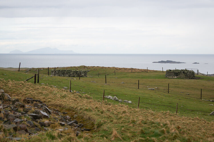
The picture below shows an area of the coast near the Boyne known locally as Maggie Reid’s Gyo (a gyo as defined in the Shetland dictionary is “a creek in the seashore with steep, rocky sides”). Local history tells the story from the 1840s of a woman called Maggie Reid who very sadly ended her life by throwing herself into the sea at this gyo. She was engaged to a young man (a distant relation of mine) who had gone away to sea and never came home, so it was presumed he was dead. His father was a widow and had been left with 4 children, and because she thought her love wasn’t coming back, Maggie Reid married him. One day her fiancé (her now husband’s son) came back; suffering such anguish Maggie Reid threw herself into the sea leaving her clogs and wedding ring at the edge of the cliff.

On my way home I cut over the hill where a Coastguard hut still stands. This hut was used until the 1950s to look out for boats in distress in rough weather. My Grandfather and another local man would man the hut during periods of bad weather where they had a telephone to connect to the Coastguard if and when they needed to.


And soon I was heading back home and looking forward to a cuppa!
I hope you enjoyed my little tour of Wast Ower!